• Help Support Hardline Crawlers :

Reiter Updates: Summer/Fall 2010

Was it settled or discussed with Stan/DNR how much trail will be deemed necessery for opening. I know we talked about it a bit at the RTW meeting, but that was more a discussion than anything...
Its been discussed but nothing is in stone yet. $$ has to be established and contracts made for certain aspects of the trail development. Thats going to be a big determination on what we start with.
 
-Is there room for future growth of trails, meaning, once the main set of trails have been built, in a few years will we be able to possibly build more trails or improve on existing trails?
Not really we have used up all of the available land that was allocated to the 4x4s. If more land comes available then we can hope to get more trails
how many miles of trails are to be expected?
That is still being calculated. It
 
its looking good out there i went it through some of the trails just me and my pooch ..um i would say that in my opinion there will be 6-8 miles open to the public..maybe more i am gonna head back out there tommorrow and double check i like going at night and shooting bats with my .410

don't forget the porcupines!

As far as opening miles goes, I don't think there is a number... I think it should open when we believe that there is enough trail that the park can be self sustainable without the need for a considerable enforcement presence. This means enough trail to make the 'rednecks' happy as well as enough variety to give everyone a little something.

Money, Charlie, you're doing great work down there :awesomework:
 
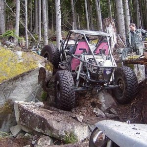
Spent the last two days with the trail designer and the consultant walking around. We talked a lot about the tight and twisty trails, general use trails ( like rino land ) medium and major
Walked out through BYS and SOL and cable trail got lots of ideas and discussed a lot on how to reproduce fetchers. Today we walked OM and same thing taking pics and talking ideas. As far as in my eyes this is one of the biggest couple days as far as getting trails that we want

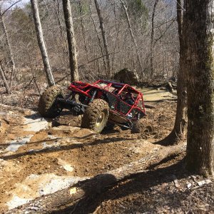
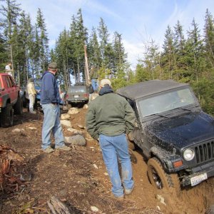
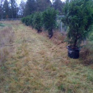
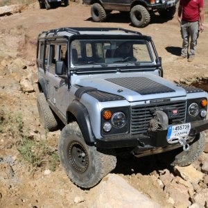
Here are a few pics of my day
View attachment 45332

View attachment 45333

View attachment 45334

View attachment 45335

View attachment 45336
 

Attachments

  • One.JPG
    One.JPG
    47.5 KB · Views: 384
  • two.JPG
    two.JPG
    45.1 KB · Views: 380
  • three.JPG
    three.JPG
    43.6 KB · Views: 384
  • four.JPG
    four.JPG
    38.1 KB · Views: 427
  • five.JPG
    five.JPG
    41.7 KB · Views: 380
I would like to update this:

ETA on when trails will actually be breaking ground? anything on when DNR would like to see Reiter reopened?

We'd like to see the 1st phase opened this Fall. 1 green, 1 yellow, 1 purple......maybe the red trail as well.

Will it? Weez atry'n......:redneck:

Reiter will not be opened in the Fall, as hoped. There are still permits that are 6 months* out and funding will be a never ending hurtle to get over.

*may be longer

New estimate: 1 year from today. This is very general estimate to satisfy curiosity, rather than committing to an actual date.


Don't give up hope on Reiter

Don't waste your impatience on Reiter

One day at a time......:awesomework:
 
This weekend (at the work party) we cleared two trails (of the 20+ proposed) free of logs, brush, small trees and black berry bushes, 6-8 feet wide. The reason for doing this was to define the trail(s) and to start the process of building these pathways into sustainable 4x4 trails. I believe the next step will be to measure how deep the duff/sluff is on the forest floor. The following step will be to scrape off this material off to the side of the pathway; making it a "trail"......an unfinished trail. The end goal is to reach the "hard bed" of this corridor......rock.


Also, the allowable maximum gradient (degree of slope) was revealed. It was explained like this:

**For a 10 foot section of trail, there will be a maximum of a 50% grade (30 degrees) that can be built into the trail (obstacles). What does this mean? Don't freak out (as I did) due to the apparently tame climb angle. I'm unable to provide a real life example, but think if it like this: the "rise" (the end vertical height of a 10 foot section at a 50% grade) is 4+ feet.

DON'T THINK IN STRAIGHT LINES, as this will fool you into it's tame nature. Rather, understand that a 50% grade in 10 feet can lend a generous amount of difficulty.......if built correctly.

**I'm no math whiz and kinda wing'n this one, so if anyone would like to correct my math or examples......please do.


Edit: the "Red Trail" (the buggy trail) will not be limited to this gradient. The maximum 50% grade is for all the other trails though.
 
Last edited:
This weekend (at the work party) we cleared two trails (of the 20+ proposed) free of logs, brush, small trees and black berry bushes, 6-8 feet wide. The reason for doing this was to define the trail(s) and to start the process of building these pathways into sustainable 4x4 trails. I believe the next step will be to measure how deep the duff/sluff is on the forest floor. The following step will be to scrape off this material off to the side of the pathway; making it a "trail"......an unfinished trail. The end goal is to reach the "hard bed" of this corridor......rock.


Also, the allowable maximum gradient (degree of slope) was revealed. It was explained like this:

**For a 10 foot section of trail, there will be a maximum of a 50% grade (30 degrees) that can be built into the trail (obstacles). What does this mean? Don't freak out (as I did) due to the apparently tame climb angle. I'm unable to provide a real life example, but think if it like this: the "rise" (the end vertical height of a 10 foot section at a 50% grade) is 4+ feet.

DON'T THINK IN STRAIGHT LINES, as this will fool you into it's tame nature. Rather, understand that a 50% grade in 10 feet can lend a generous amount of difficulty.......if built correctly.

**I'm no math whiz and kinda wing'n this one, so if anyone would like to correct my math or examples......please do.

Only 2--me and charlie did one all by ourselfs :haha: so you can chaulk that up to 3 this weekend.
 
Also, the allowable maximum gradient (degree of slope) was revealed. It was explained like this:

**For a 10 foot section of trail, there will be a maximum of a 50% grade (30 degrees) that can be built into the trail (obstacles). What does this mean? Don't freak out (as I did) due to the apparently tame climb angle. I'm unable to provide a real life example, but think if it like this: the "rise" (the end vertical height of a 10 foot section at a 50% grade) is 4+ feet.

DON'T THINK IN STRAIGHT LINES, as this will fool you into it's tame nature. Rather, understand that a 50% grade in 10 feet can lend a generous amount of difficulty.......if built correctly.

**I'm no math whiz and kinda wing'n this one, so if anyone would like to correct my math or examples......please do.


Edit: the "Red Trail" (the buggy trail) will not be limited to this gradient. The maximum 50% grade is for all the other trails though.

Where did this information come from?
 
Where did this information come from?

This is the way Charlie (nowires) explained it to me/us at the work party on Saturday. I believe it was explained to him by the trail engineer. And had been mentioned by the trail designer (a meeting I was at) as well.
 
A trail designer or engineer would still have specs to work with in constructing 4x4 trails. Where did they get this info? It can't be just a "whatever the trail designer/engineer says will work" type of thing can it?

DNR uses FS guidlines in general which are provided by USDA.

This is what we were given by the DNR at the volunteer training. Doesn't seem to apply to 4x4 trails or even motorized trails at all.


ps,
Sorry to clutter this thread, If we need to move this thats cool.
 
A trail designer or engineer would still have specs to work with in constructing 4x4 trails. Where did they get this info? It can't be just a "whatever the trail designer/engineer says will work" type of thing can it?

Good question.

It was explained like this: No ORV park has even been designed/engineered, like Reiter will be. So the trail designers and engineers are limited to what they can/will "sign off" on. This should not be taken as "they could do more", rather; they have a liability as to what they can/will design for Reiter. And the DNR (Olympia) must approve these (new) designs. So.......you will not find guidelines and regulations for how Reiter will/can be built.

What is being designed and engineered are/will be these "guidelines and regulations".

Bottom line: we're pushing the limits on what can be designed and engineered for an ORV park.


Side note: When complete, these "plans" will be a repeatable process for other (future) ORV park projects.
 
Opinion: After now meeting the trail designer, trail engineer and trail consultant; I have full confidence in their desire and ability to create plans for what "we" need out of an ORV park.:awesomework:
 
This weekend (at the work party) we cleared two trails (of the 20+ proposed) free of logs, brush, small trees and black berry bushes, 6-8 feet wide. The reason for doing this was to define the trail(s) and to start the process of building these pathways into sustainable 4x4 trails. I believe the next step will be to measure how deep the duff/sluff is on the forest floor. The following step will be to scrape off this material off to the side of the pathway; making it a "trail"......an unfinished trail. The end goal is to reach the "hard bed" of this corridor......rock.


Also, the allowable maximum gradient (degree of slope) was revealed. It was explained like this:

**For a 10 foot section of trail, there will be a maximum of a 50% grade (30 degrees) that can be built into the trail (obstacles). What does this mean? Don't freak out (as I did) due to the apparently tame climb angle. I'm unable to provide a real life example, but think if it like this: the "rise" (the end vertical height of a 10 foot section at a 50% grade) is 4+ feet.

DON'T THINK IN STRAIGHT LINES, as this will fool you into it's tame nature. Rather, understand that a 50% grade in 10 feet can lend a generous amount of difficulty.......if built correctly.

**I'm no math whiz and kinda wing'n this one, so if anyone would like to correct my math or examples......please do.


Edit: the "Red Trail" (the buggy trail) will not be limited to this gradient. The maximum 50% grade is for all the other trails though.

And to throw a quick note in
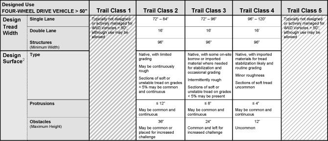
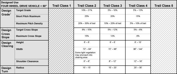
these re trail standards for Reiter. Engineered designed obsticals can go greatter than that
 
So, hopefully you are saying that we are not completely limited to a 50%, a.k.a 5 foot rise to 10 foot run, a.k.a., for operators, and grade checkers 2:1 slope.

Hopefully, they are speaking about an "overall profile" of rise in any given 10 feet.

So, any of these would be acceptable??
 

Attachments

  • 1111111118878454.GIF
    1111111118878454.GIF
    10.1 KB · Views: 200
This is what we were given by the DNR at the volunteer training.

I think you got jipped Neil because the rest of us got the 2007 edition which covers "the half rule" which is "The trail grade should be no more than half the sideslope grade.". I have a few copies of this for anyone who wants one. Show up for the Walker work party on the weekend of the 21st and I'll give out what I have....4 or 5 copies.:awesomework:
 
Back
Top