japerry
Well-Known Member
I was surprised to see that no one has talked about TSF's Airplane Hill. From everything I've heard about the Reiter plan, it will end up being very similar to what Airplane Hill is.
*Thanks Wes for the photos!*
Some main features of a good trail build:
Airplane Hill has all these features. Before the rebuilding, it was a steep hill climb, that at its worst, not even 49" high powered buggies could make it up. ODF (Oregon's DNR) closed the trail and consulted with groups to reopen it in a sustainable fashion.
Signage is the first thing you see to indicate you're at Airplane Hill, and the difficulty. Notice that the signs are made with that particle plastic. This makes them EASY and inexpensive to replace:

Now, Airplane hill has gates on both sides of the trail, as well as filters to keep anyone with less than 33s out.

Lockers aren't really needed to get through, so there is still a way around the hard obstacle.
The climb has large rock everywhere, which makes it hard to dig large ruts or cause massive erosion. However, there are sediment traps at the bottom to keep any moving silt from going any further from the floor.
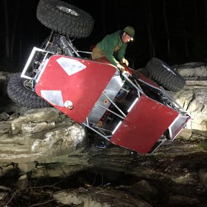
The trail is like this, although its hard to see the hill, the second pic shows a rock nearly as tall as my jeep (hood). I took the left way, but buggies can be challenged to the right:


At the end, there is another filter:

Some videos of building it:
http://www.youtube.com/watch?v=73LsMrHajxk
http://www.youtube.com/watch?v=Q1jFYIw2xKI
Some videos of entering the trail, notice the gate at the end of the filter. (btw, 4000lbs of concrete is what makes up the posts for this gate. it'd be hard to take down..):
http://www.youtube.com/watch?v=FhuO-uhpDio
This is what I see Reiter turning into. Will it be BYS or outlet mall? probably not. But it will make things difficult for anyone with 37" or under tires, and at least interesting for those who're well equipped.
*Thanks Wes for the photos!*
Some main features of a good trail build:
- Proper Signage
- Obsticale/Filter/Shoefly to keep the unequiped out
- Gates on both sides to EASILY close the trail
- well defined borders for the trail
- designed paths for all vehicles that can pass the shoefly
- man-made rock to build into the hill
- between 800-2000ft long
Airplane Hill has all these features. Before the rebuilding, it was a steep hill climb, that at its worst, not even 49" high powered buggies could make it up. ODF (Oregon's DNR) closed the trail and consulted with groups to reopen it in a sustainable fashion.
Signage is the first thing you see to indicate you're at Airplane Hill, and the difficulty. Notice that the signs are made with that particle plastic. This makes them EASY and inexpensive to replace:
Now, Airplane hill has gates on both sides of the trail, as well as filters to keep anyone with less than 33s out.
Lockers aren't really needed to get through, so there is still a way around the hard obstacle.
The climb has large rock everywhere, which makes it hard to dig large ruts or cause massive erosion. However, there are sediment traps at the bottom to keep any moving silt from going any further from the floor.
The trail is like this, although its hard to see the hill, the second pic shows a rock nearly as tall as my jeep (hood). I took the left way, but buggies can be challenged to the right:
At the end, there is another filter:
Some videos of building it:
http://www.youtube.com/watch?v=73LsMrHajxk
http://www.youtube.com/watch?v=Q1jFYIw2xKI
Some videos of entering the trail, notice the gate at the end of the filter. (btw, 4000lbs of concrete is what makes up the posts for this gate. it'd be hard to take down..):
http://www.youtube.com/watch?v=FhuO-uhpDio
This is what I see Reiter turning into. Will it be BYS or outlet mall? probably not. But it will make things difficult for anyone with 37" or under tires, and at least interesting for those who're well equipped.
Last edited:
 I say we try an throw a elbe log challenge style obsticle in the lower section. Maybe a few stairsteps built outa logs. We could also make the upper section (way up, past the egg rock, in the newer clear cut) challengeing as a gate keeper, as its easily accesable from the road.