• Help Support Hardline Crawlers :

wheelin off highway 2

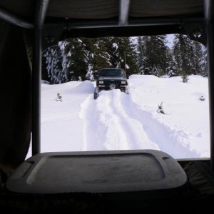
You have to pack your truck in like a hiker...:rolleyes:


Cutting off access to the trail that's "OK" to be on is ****ing brilliant...:mad: Somebody got a raise for coming up with that...


Then again, can't these roads be grandfathered in??? Like a "right of way"???


Is this something that the PNW4WDA can fund and fight???


I may never use these roads, but if we can keep them open and learn from the experience for future engagements, that would be great... Being that the PNW4WDA has a lot more members, resources and hands on experience, I would like to see/help if there's something we can do legally...


Is there anything we can do at this point Jim???

There should be a contact person on the FS website. That would be my first contact if I had a complaint. I am sure that Arlene is studying the maps and checking for issues and deletions that we agreed to.
 
Nope...

2-1/2 to 3 years ago now (if I recall correctly) there were some meetings held in different districts regarding the new "Motorized Travel Plan". The first meetings were to tell everyone what was going to be happening and when.

They then gave everybody that was interested (WOW, PNW$WDA, horse clubs, hikers, etc.) a chance to chart and submit trails that they would like to see on the map. If you submitted it, it would be considered. If no one spoke up for a trail or area, it would automatically NOT be considered, and treated as if it didn't exist.

Some of us GPS'ed trails that we really thought should be "considered". Some of those trails/areas didn't make it.

We had our say...

The interesting thing is that this new plan is soon to be nation wide, yet it is hardly heard of until AFTER the maps are created and put into LAW.

Regardless of web presence, thoughts of club presence and representation, this is the kind of disconnect that occurs in our hobby. Over three quarters of our hobby's enthusiasts don't even understand what a green dot/marked trail system means...

They surely won't/don't understand what this map will mean.

Very well put
 
The best thing to do is not post anything about wheelin anywhere on this site because someone will pick it apart and tell you that you are doing wrong even if they have no idea where you are.
 
The best thing to do is not post anything about wheelin anywhere on this site because someone will pick it apart and tell you that you are doing wrong even if they have no idea where you are.


yup,,, we should all just tell each other,, I went wheeling..

Undisclosed location.

our trails might stay open this way.
 
So they have omitted roads from the map....cool...Wait till someone gets lost and dies because they had a Forest Circus map without all the roads for landmarks to get back home... And when rescue crews go to search for them, they wont see a road on the map to potential drive down or reference as a landmark to search for the victim...:awesomework: This is a cool system.

They should probably take the lakes and rivers off the map unless the legal roads drive to them or across them via a bridge. Otherwise there is no reason to be there :awesomework:

This is just "a" map not necessarily "the" only map of the area. The purpose of this map is to show what is open for use. If you want to know what else is up there then get a different map.:awesomework:
 
yup,,, we should all just tell each other,, I went wheeling..

Undisclosed location.

our trails might stay open this way.

Thats not going to change crap. Its those "many" "many" uneducated non internet using folks that do a very large portion of crap that makes us loose our places to play.

I have yet to see a place closed by folks who were educated and respected what they were using.
 
Thats not going to change crap. Its those "many" "many" uneducated non internet using folks that do a very large portion of crap that makes us loose our places to play.

I have yet to see a place closed by folks who were educated and respected what they were using.
Hey Crash: Is there a way that we could or maybe we do, But this site for example. Create a condensed version (a education Thread,1 that can not be respond`d to, but only has the info) easy to use,find no b/s mix`d in,just fact`s??? I ask this as I am one of those folk`s that need`s, and or can use more education on this matter. Also I would like to see Us be able to continue in our sport.
 
This is just "a" map not necessarily "the" only map of the area. The purpose of this map is to show what is open for use. If you want to know what else is up there then get a different map.:awesomework:

I have THOSE maps....but it seems silly to have to carry TWO maps of the SAME place because the maps of the SAME area have DIFFERENT stuff on them....:redneck:
 
Nice. And good for you for being proactive about getting out and driving around on some cool old FS roads. Screw all these pussies on here that have a problem with it. Go wheeling. Be responsible. Enjoy the great outdoors. Looks like a beautiful day and a fun place to be in your stock rigs:awesomework::beer:
 
Nice. And good for you for being proactive about getting out and driving around on some cool old FS roads. Screw all these pussies on here that have a problem with it. Go wheeling. Be responsible. Enjoy the great outdoors. Looks like a beautiful day and a fun place to be in your stock rigs:awesomework::beer:

There used to be some cool stuff farther up before the road wahsed out. Went across the only bridge on the left and there were some sceenic/not hard old skidder trails along with some good camping spots.
 
The best thing to do is not post anything about wheelin anywhere on this site because someone will pick it apart and tell you that you are doing wrong even if they have no idea where you are.

yup,,, we should all just tell each other,, I went wheeling..

Undisclosed location.

our trails might stay open this way.

Yep. Sad but true. The key is to drawing less attention and wheeling responsibly.
 
There used to be some cool stuff farther up before the road wahsed out. Went across the only bridge on the left and there were some sceenic/not hard old skidder trails along with some good camping spots.

Did you see that Prius on it's lid Sat. night! holy cow:eeek: What a ride that would have been! ..ok back on topic
 
I have THOSE maps....but it seems silly to have to carry TWO maps of the SAME place because the maps of the SAME area have DIFFERENT stuff on them....:redneck:

This is in my opinion the flaw in this new map system. The main focus of this map is to show the roads the FS maintains and says are ok to drive down. As the FS does not maintain the other public roads and highways they don't say much on their map about these roads. Although you are only required to have the 1 map it seems to me that in order to effectively use it you would have to also have a regular street map.
 
Last edited:
You can try to educate people all you want on this board but the bottom line is your only talking to a small hand full of people that already know right from wrong.
If you really want to do this you need to be out in the woods every weekend doing nothing but talking to people. Not behind the keyboard.
 
Top