• Help Support Hardline Crawlers :

Reiter Trails??

i guess its gonna be kinda hard to map out trails ive never heard of/ been on.

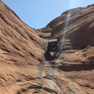
Guess i gotta go up there with my GPS and hit some of the trails. On second thought what would you rate the trails "we" have been talking about? (Grumpy Trail, Trail of Doom, Rhinoland, etc.)
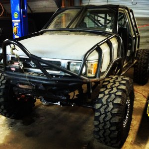
You think a Cherokee with a 4.5" lift rollin on 33s and open front and back could make them??

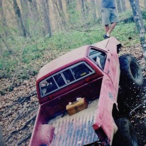
Grumpy trail maybe,rhinoland dout it,Trail of doom don't even think about it,bonus round cake,Beat your **** run away:haha:

Poop trail too narrow unless you don't care about your body....
 
Ya i know about BYS!! What is on Trail of Doom and that stuff, lots of rocks and stuff??


Why did u miss highrider? Must have been fun.
 
Ya i know about BYS!! What is on Trail of Doom and that stuff, lots of rocks and stuff??


Why did u miss highrider? Must have been fun.

I didn't miss highrider "I wheeled highrider"and what a ****in awesome trail it was...Trail of doom is stump tree,stump tree,and mud when it rain's if your open frt and rear good luck and I hope you have a good winch and battery because your going to need them both....
 
well screw that. I'll walk it if i have to!:kissmyass:
Have you been down that trail off the izzy trail? It starts on the hairpin turn.
My friend and I went down a ways and stoped at the part where there is a tree laying in the middle of the trail?
I think crash said it goes to a gravel road and through some private land?
Can you get out of reiter that way? Or get in to reiter that way?
 
you get in and out of reiter via reiter rd. If you want to know where these trails are you just have to get out and hook up with a group and run them.
 

Attachments

  • TOPO!map.jpg
    TOPO!map.jpg
    51.9 KB · Views: 143
  • TOPO!map2.jpg
    TOPO!map2.jpg
    36.3 KB · Views: 144
highrider was closed because people would shoot the microwave towers at the top. so the people that owned the towers had the trail closed:booo:
 
ya i've got the trail position of cable trail. Havnt put it on there yet. I'll get to it later today. If anyone has any data on where other trails are, help me out!! We will get all the trails eventually......
 
Top