It was like that when I ran that section 3 years ago. Even then it looked like it had been there for a long time already. You must be thinking of a different spot.
Must be.
It was like that when I ran that section 3 years ago. Even then it looked like it had been there for a long time already. You must be thinking of a different spot.
Were does it say that isn't part of the trail? If it is not, it should be posted or mounded up like the walking part of the trail that is the next section. We ran this same trail last July and it looked the same as it did this year. No sign until the next section.And I drove through there on the redeye run just before it closed up for the winter. Just because someone blazed a new illegal trail does not mean it's open. You know that. Naches has been getting hammered in the past couple years, the east end of the trail is starting to resemble Tahuya. There are people trying to close that trail, don't give them more ammunition.
I was typing when you posted.go back and read my last few posts.:kissmyass:

Yes, because of my dial up has a hard time loading some times plus I am Wheeler, not good typist.It took you a whole 3 minutes to type that? :silly15: :;

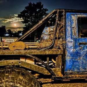
Come over of you want to see the other 90 pics of Saturday.
To take my own damn pics? and wheel the trails? :booo: :booo:It took you a whole 3 minutes to type that? :silly15: :;
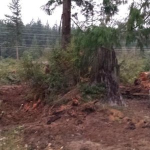
Karl must be wrong. The area I'm talking about looks nothing like that as of last year but has the opportunity if some asshat decides to cut it out.

The extreme west end of the trail is signed no motorized use, foot and horse only. As you drive up road 70 you cross this section of the trail, take a fork to the left leaving 70 and turn a hairpin left, and then come to the steep climb on your right where the little naches starts. This is the climb I thought you were referring to. As you go up it cuts sharply to the right and then wraps back around to the left with some rocky sections. You could concievably cut straight up past the climb instead of following the trail to the right, and that is what it looked like in your picture. I cannot for the life of me picture where else on the trail that those pics could be. 9 months seems to be beyond the capability of my memory now, I must be getting old. :redneck:Are you talking about the area at the EXTREME end of the trail. Essentially you go down one big hill, cross a road, and then there is another dropoff, you can go down that to another road. Then there IS a blocked off area that leads to where they lowered the wagons off that cliff back in the day.
Here are my mad ms paint skills. If we were in the wrong (which I don't think we were), than whomever controls that trail needs to have a work partay to block that section off and sign it. If there is a work partay for it, I would be more than happy to attend.
The extreme west end of the trail is signed no motorized use, foot and horse only. As you drive up road 70 you cross this section of the trail, take a fork to the left leaving 70 and turn a hairpin left, and then come to the steep climb on your right where the little naches starts. This is the climb I thought you were referring to. As you go up it cuts sharply to the right and then wraps back around to the left with some rocky sections. You could concievably cut straight up past the climb instead of following the trail to the right, and that is what it looked like in your picture. I cannot for the life of me picture where else on the trail that those pics could be. 9 months seems to be beyond the capability of my memory now, I must be getting old. :redneck:
sadly, that section you marked "where pics were taken" might be what I'm talking about. It is not open to 4x4 use, the signs keep getting knocked down.
Yup, after veiwing this map, it appears we WERE in the wrong.
http://www.nwjeepn.com/Maps/Lwrnaches.pdf
This is such BS! You are out of line! NO one knew this was closed. For it not to be blocked off and nothing marked it can be confusing. There are a lot of road crossings coming down this trail. We stopped at the end where it said not to go. We tread lightly. You have no right to jump our **** and call us liers. I am pissed that you would say we broke any rules knowingly or tore up anything.I am 100% certain that someone on that run knew that.
You have never been lost? Kiss my ass!The signs come and go, but you need to know where you are. Just because there isn't a sign doesn't mean it's open. No excuses.
I'm going to head out there this coming weekend and clear it up for sure. But now that we've figured out this much, that section has been closed for as long as I've wheeled that trail. Not as long as some of you but over 10 years. I am 100% certain that someone on that run knew that. The signs come and go, but you need to know where you are. Just because there isn't a sign doesn't mean it's open. No excuses.
I'm going to head out there this coming weekend and clear it up for sure. But now that we've figured out this much, that section has been closed for as long as I've wheeled that trail. Not as long as some of you but over 10 years. I am 100% certain that someone on that run knew that. The signs come and go, but you need to know where you are. Just because there isn't a sign doesn't mean it's open. No excuses.
WTF who's this Kraut Guy?
Not everyone has a MAP or High dollar GPS .
Keep in mind the trail is managed by two seperate districts.****, I'll let the FS know what is going on tomorrow. And get an answer back from them.
:wtf: do you think I'm doing???Next time you might educate us on closed trails instead of jumping us.
WTF who's this Kraut Guy?
Grow up.