You are using an out of date browser. It may not display this or other websites correctly.
You should upgrade or use an alternative browser.
You should upgrade or use an alternative browser.
Government Meadows
- Thread starter Roger
- Start date
426rider
Well-Known Member
Government meadows is on the Naches trail. The west side of the Naches trail is open July 15th til November 15th. You can call the USFS office in enumclaw and get this information also. Here is a link to the northwest region of the USFS
http://www.fs.fed.us/r6/welcome.shtml
http://www.fs.fed.us/r6/welcome.shtml
2pwrlftrs4u
NWW Meanie
:awesomework: glad he asked instead of going there to see if it was open...
*open to most = the ability to get there
*open to most = the ability to get there
white river ranger station 360-825-6585. But as devon posted the west side is closed til july 15
") Thanks Jim, that was the number I've been looking for.
Thanks Jim, that was the number I've been looking for.Of course if you're hiking it it's open year round. It's closed only to 4x4 use during the dates stated.
No, I took my 12" lifted, 44" Boggered, turbo charged cummin's, mud wumpin' Dodge. :redneck:
To avoid some sort of mis-understanding and flame war the board is so famous for "JUST KIDDING!" I'm new around here and trying to learn the ropes, but I do pay attention. :haha:
No, I took my 12" lifted, 44" Boggered, turbo charged cummin's, mud wumpin' Dodge. :redneck:
To avoid some sort of mis-understanding and flame war the board is so famous for "JUST KIDDING!" I'm new around here and trying to learn the ropes, but I do pay attention. :haha:
Sorry, I forgot the :fawkdancesmiley: and the :; and this one too :kissmyass:
crash2
-Oh no I picked a side-
Of course if you're hiking it it's open year round. It's closed only to 4x4 use during the dates stated.
I am pretty sure roger followed all the rules--he's an old school wheeler :awesomework:
I am pretty sure roger followed all the rules--he's an old school wheeler :awesomework:
Stop taking me so seriously. :silly15: Gosh. :haha:
I am pretty sure roger followed all the rules--he's an old school wheeler :awesomework:
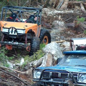
Old is right. Actually I haven't been up there in a few years. The only run I made was in September, all the way over to Tri-pod and out. Had a blast and was wondering when I could head out again.
CrustyJeep
Well-Known Member
:haha:I'm new around here and trying to learn the ropes...
Mike V.
Member
i know the westside is closed until july 15th, but are you able to start on the little naches side (kaner flats area) and go to the snowmobilers cabin and turn around?? basically, can you drive the eastside without crossing over?? i can't seem to find that info on the fs sites.
i called and left a message with the orv supervisor at the naches station.
i called and left a message with the orv supervisor at the naches station.
GRNTACO
This Space Blank
i know the westside is closed until july 15th, but are you able to start on the little naches side (kaner flats area) and go to the snowmobilers cabin and turn around?? basically, can you drive the eastside without crossing over?? i can't seem to find that info on the fs sites.
i called and left a message with the orv supervisor at the naches station.
Nope, the line is the last road you cross before you get to the cabin. I would guess around a mile before you get to it.
benw1
Well-Known Member
i know the westside is closed until july 15th, but are you able to start on the little naches side (kaner flats area) and go to the snowmobilers cabin and turn around?? basically, can you drive the eastside without crossing over?? i can't seem to find that info on the fs sites.
i called and left a message with the orv supervisor at the naches station.
Yes you can get to the cabin from the east side. Last time I checked, the seasonal closure signs are at the bottom of the big hill west of the cabin.
GRNTACO
This Space Blank
Yes you can get to the cabin from the east side. Last time I checked, the seasonal closure signs are at the bottom of the big hill west of the cabin.
I am pretty sure (100%) driving to the cabin from either side between the closed dates is not allowed........I am trying to find the map and info I seen about this.....so I could be wrong about the line....but not likely.

Mike V.
Member
Nope, the line is the last road you cross before you get to the cabin. I would guess around a mile before you get to it.
thanks GRNTACO. if i hear different info from the ranger i will post it up.
Last edited:
The border is or at least was the crest trail. enforcement of the area was taken over by the Naches district a year or so back so I am not sure if they have moved the boundry to include the cabin from the east side. (since the crest trail is right behind the cabin) So Roger are you talking about the boyscout sign with the wagon on it? We put that up a few years back with the boyscouts.