You are using an out of date browser. It may not display this or other websites correctly.
You should upgrade or use an alternative browser.
You should upgrade or use an alternative browser.
How difficult are the trails at elbe now?
- Thread starter slideshow86
- Start date
 uke:
uke:Mark m.
Well-Known Member
If your into MUD its the place to go.:rb:
Im scared of Elbe. I feel much safer in front of my warm key board..:flipoff:
 :rb:
:rb:crazybluerider1
Well-Known Member
What is that?
What is that?
A repost from earlier. Inside the zip file is a GPS tracing of most of the trails at Elbe. I've got about 80% done and have been adding some landmarks etc. I still have the busy, swamp trail and alder loop to finish it up. I also want to mark major obstacles with local names or descriptions, such as toboggan hill, the various bridges etc. There are some spots like the mud hole bypass on the busy that I want to map and mark.
I want to get up there with Nancy and just run all the legal roads in the area (some of them don't show up on the topo map, so that we know where we can drive ORVs vs street legal, which ones are off limits roads for loggers etc.
I was going to do Evan's Creek and probably will but with all the changes going to happen there I'm not sure how accurate it would stay for how long.
You'd need a Garmin GPS or know how to convert the Garmin data file to the GPS format for Magellan or whatever else someone might use. The current Elbe maps are wrong in the lot of areas and new sections have been added like the swamp trail, the inner alder loop, the upper section of rainier vista, non of that is on the current maps. This will also give us an accurate up to date mileage count.
Last edited:

:haha:
:haha:The trails are fine as long as you stay on the bridges
crazybluerider1
Well-Known Member
A repost from earlier. Inside the zip file is a GPS tracing of most of the trails at Elbe. I've got about 80% done and have been adding some landmarks etc. I still have the busy, swamp trail and alder loop to finish it up. I also want to mark major obstacles with local names or descriptions, such as toboggan hill, the various bridges etc. There are some spots like the mud hole bypass on the busy that I want to map and mark.
I want to get up there with Nancy and just run all the legal roads in the area (some of them don't show up on the topo map, so that we know where we can drive ORVs vs street legal, which ones are off limits roads for loggers etc.
I was going to do Evan's Creek and probably will but with all the changes going to happen there I'm not sure how accurate it would stay for how long.
You'd need a Garmin GPS or know how to convert the Garmin data file to the GPS format for Magellan or whatever else someone might use. The current Elbe maps are wrong in the lot of areas and new sections have been added like the swamp trail, the inner alder loop, the upper section of rainier vista, non of that is on the current maps. This will also give us an accurate up to date mileage count.
Cool. :awesomework: That is a good tool for newcomers.
I tried to open it and did not recognize the format.
The trails are fine as long as you stay on the bridges
Nice photo chop...LOL!!!:awesomework:
Lokey
Well-Known Member
A repost from earlier. Inside the zip file is a GPS tracing of most of the trails at Elbe. I've got about 80% done and have been adding some landmarks etc. I still have the busy, swamp trail and alder loop to finish it up. I also want to mark major obstacles with local names or descriptions, such as toboggan hill, the various bridges etc. There are some spots like the mud hole bypass on the busy that I want to map and mark.
I want to get up there with Nancy and just run all the legal roads in the area (some of them don't show up on the topo map, so that we know where we can drive ORVs vs street legal, which ones are off limits roads for loggers etc.
I was going to do Evan's Creek and probably will but with all the changes going to happen there I'm not sure how accurate it would stay for how long.
You'd need a Garmin GPS or know how to convert the Garmin data file to the GPS format for Magellan or whatever else someone might use. The current Elbe maps are wrong in the lot of areas and new sections have been added like the swamp trail, the inner alder loop, the upper section of rainier vista, non of that is on the current maps. This will also give us an accurate up to date mileage count.
Take a look at this tool to convert GPS Data from one format to another.
http://www.gpsbabel.org/
Nice photo chop...LOL!!!:awesomework:
I'd like to take credit, but it was sent to me my an old school wheeler, yes older than me :redneck:
Clark
Well-Known Member
That white 4runner is BADASS!!:smokey:
Last edited:
Cool. :awesomework: That is a good tool for newcomers.
I tried to open it and did not recognize the format.
What GPS are you using?
crazybluerider1
Well-Known Member
What GPS are you using?
I dont have a GPS. I thought it was just a map file.
I dont have a GPS. I thought it was just a map file.
It's a GPS file that you can download into a GPS. They can be printed out if you have Garmin Mapping software. I'll probably do that or save it to a PDF when I get the rest done.
The idea is that for those that use a GPS will know where they are, what's legal and what's not once I'm done.
I'll be back out on January 2nd to run the other trails. I hope to have a few hours to meet up with Nancy to run the roads before the snow get's too deep for my tow rig. (Well, that's an F350 on 37inch mud terrains so I should be able to get through a little snow...)
stmpjmpr
Member
I love elbe....
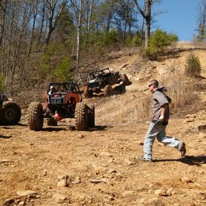
But I have not come out the two times I went without carnage. I have 4" of lift on 34's and have not done the busy yet last time I went I bent my front driveline and wrecked two wheels but I also am not affraid of carnage it is a part of real wheeling. Go to you tube and type in elbe hills and watch some of those vids it will give you some Idea as to whats in store for ya :redneck:
But I have not come out the two times I went without carnage. I have 4" of lift on 34's and have not done the busy yet last time I went I bent my front driveline and wrecked two wheels but I also am not affraid of carnage it is a part of real wheeling. Go to you tube and type in elbe hills and watch some of those vids it will give you some Idea as to whats in store for ya :redneck:
Lokey helped out by converting my file to a more standardized gps file that can convert to more software and he did a map. There's much more that we'll be able to add to this but I think you'll agree that it is a really cool start!
I also changed the compression method on the zip file so that they will open with other compression and older compression programs.
I also changed the compression method on the zip file so that they will open with other compression and older compression programs.
![IMG_1955[1].JPG](http://attachments.www.hardlinecrawlers.com/xfmg/thumbnail/12/12269-e597720ef7099e355741262886a75e1d.jpg?1625929652)