crash2
-Oh no I picked a side-
So this last summer was very productive. Me and Ken our operator were able to get more trails completed along with a few other spots repaired that we are unable to do on our monthly work parties.
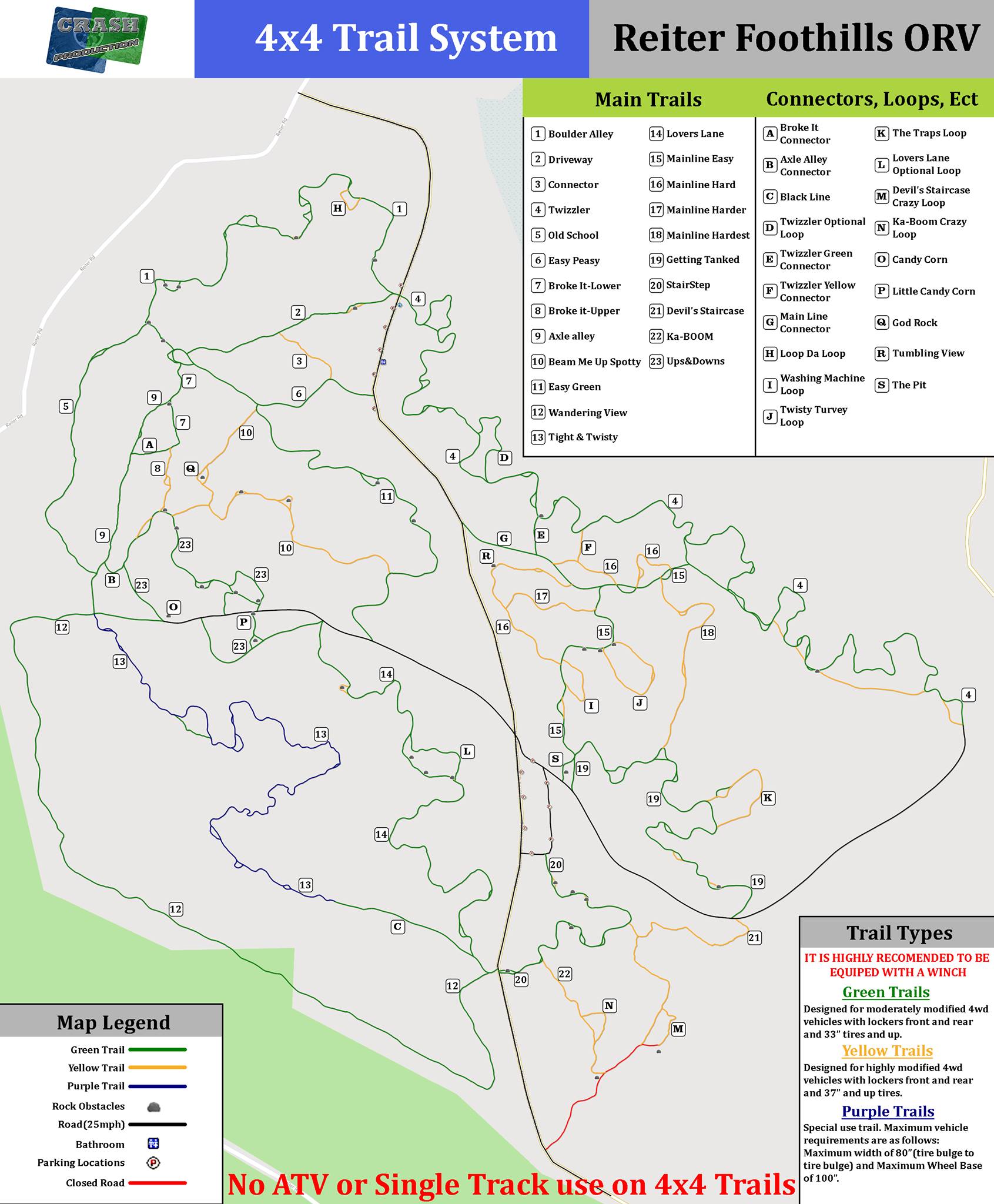
In any case the DNR is crazy slow on updating really anything and since we have a bunch of trails not on the map or not correct on the map I wanted to correct that. So I spent a god month walking every trail and getting correct GPS data and then created a new map. It was quite the learning curve I must say but I was pretty happy with the outcome..
So for the current Sepa we are now finished with all current trail projects in the 4x4 area and will hopefully start the next one here soon. As it sits we are at 10.5 miles for all trail paths.
I wanna thank the Timber tamers for hosting the Map on there system and is currently setup to use/import into the Avenza phone app...
So you can either download the map(.pdf) here https://timbertamers.org/ttwp/wp-content/uploads/2020/09/Reiter4x4TrailMap20200814.pdf or download it from here (.png)...
I am waiting for my proposal to the DNR on signage to complete the whole thing...