• Help Support Hardline Crawlers :

Manastash Directions

WA-Wheeler

Well-Known Member
Joined
Sep 1, 2010
Messages
1,753
Location
Monroe, WA
So this will be my first time riding/driving here. There is a big group of friends going and I am just looking for some good directions and/or info on road closures in that area. From what I know we are camping at the "riders camp" near buck meadows.

Any Help Would Be Greatly Appreciated!

Thanks In Advance!
 
Trip is last week of June.... to accommodate the 15th closure date..... So which side is washed out still? I thought that coming off of 90 past Cle Elum and before Ellensburg on the Taneum road it was still somewhat accessible.
 
Can you even get to riders camp yet? I don't think the road repairs are done.

Roads are still closed. Work to begin on the FS 3100 this mid July. To get to riders camp you can use the bridge across Buck Meadows on the 4W311. It's built for trail vehicles only.
 
The bottom of the road is gated and the top is washed out, not passable. The wooden bridge across buck meadows can be used but short wheel base rigs only. There is a way to bypass the bridge but you have to know the area well and it's a longer drive but any vehicle can make it. It's through Walter springs.
 
I'm not leading, I'm following. But I remembered something about the road being washed out and wanted some clarification. The group I'm going with says they know the way. I guess we will see.
 
Manastash

The wash out was repaired last year, don't think is washed out again, fairly certain the road is fine, you can dip down into the Manastash area through Barber Springs by coming in through the Observatory area, gets kinda confusing but hey :beer:
 
The wash out at the bottom of the road and the one at buck meadows are still present. (people just drove around the lower wash out) The road is gated at the bottom. They're supposed to be fixed this year. You can come over from the Naches through Barber springs and then drive up the road to the campgrounds.
 
Trying to figure out how to get to funny rocks from the west side.. My friend said to run Manastash, then left onto Barber springs. From there I don't know. Anyone know the longitude, and latitude of funny rocks so I can Google Earth it?

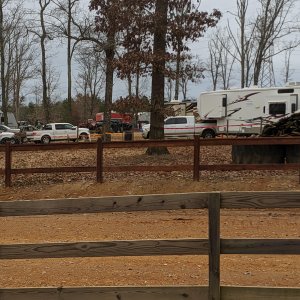
Also, how far up can I get with the R.V., and trailer before I need to set up camp, and wheel in?
 
Its about a good hour of wheeling to get to the funny rocks. Lots of camping around the area and even a toilet :awesomework:

That being said....those switch backs up the mountain can be brutal had an RV completely DESTROY its tranny. Just a warning.

Have fun!
 
Thanks. I finally found the rocks on Google Earth. Still not sure of the route I'm going in, but we'll figure it out.
 

Latest posts

Top