• Help Support Hardline Crawlers :

Naches trail, will it fit?

Dogboy

Well-Known Member
Joined
Mar 20, 2008
Messages
771
Location
Enumclaw
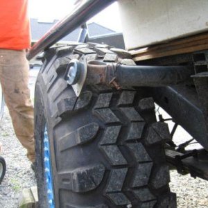
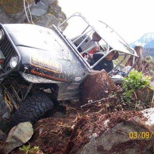
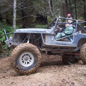
My cousin, a couple friends, and I were thinking about going over to Little Naches next weekend (the 18th/19th). We were thinking about running the Naches trail over there Saturday morning, camping/ riding/ wheeling, and driving the highway home Sunday. My question is, do you all think my cousin's Ram 1500 with fit down the Naches Trail? It is a 97 Ram 1500 ext cab short bed. We aren't concerned about capability, because we are pretty damn sure it will is capable enough, but we just aren't sure how close together the trees and crap are, because he's never been over it, and the last time I went over was probably 5-6 years ago when I was 12-13 y/o, and it was on dirtbikes, so I wasn't paying attention to how wide things were. He doesn't like body damage, but if **** happens, oh well (it has seen the 311 at Evans creek twice).

That being said, if anybody wants to join us, let me know, more people are welcome, we just aren't quite sure what our plan is yet.

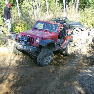
EDIT: also what about the trails at Naches. I've been to Funny Rocks, but would the above Ram be able to fit out there as well? I've been out there a few times, but I was younger and don't remember too much.
 
Hey you would be fine meet over there with my parents and kieth we took a mog thru there a couple years back had no problems. nachees is known for being wide open. my parents should be camped by the river right after the gravel pit coming down from the nachees trail they are on the left look for the land cruiser Ill tel my dad to put up some signs look for blast.
 
Hey you would be fine meet over there with my parents and kieth we took a mog thru there a couple years back had no problems. nachees is known for being wide open. my parents should be camped by the river right after the gravel pit coming down from the nachees trail they are on the left look for the land cruiser Ill tel my dad to put up some signs look for blast.

Alright, but damnit... :mad:.
My dad would love to come along if he knew that, but I already have somebody riding in the passenger's seat... I doubt either of them want to ride in the jump seats all weekend, haha.

I'll keep an eye out for them, and I'll stop by and say hi. I'll see, maybe my dad wants to drive to Cle Elum, and get his dual sport and ride that over there or something, but I doubt it.
 
Yes it will fit but expect body damage. We ran it all the way through from the rabbit holes on the eastside to the cliffs on the west side yesterday and there are still a lot of tight spots as well as a couple of damaged bridges. If your going to go start in at the cabin and get off after the last bridge by the 1913 road. Watch the exit off of the last bridge it will be sketchy in a bigger rig. I wouldnt run the secton on the east side of the 1913 the side hill by the river is getting quite narrow and its about a 300' drop to the river.
 
I am sorry I meant right coming from the naachees trail. What day you guys heading over Maybe I will talk the wife into letting me ride up with some of my buddys heading up.
 
Yes it will fit but expect body damage. We ran it all the way through from the rabbit holes on the eastside to the cliffs on the west side yesterday and there are still a lot of tight spots as well as a couple of damaged bridges. If your going to go start in at the cabin and get off after the last bridge by the 1913 road. Watch the exit off of the last bridge it will be sketchy in a bigger rig. I wouldnt run the secton on the east side of the 1913 the side hill by the river is getting quite narrow and its about a 300' drop to the river.

Ok, thanks. Is the road we should exit on, marked with some kind of marker saying what road it is? If I'm not mistake, it crosses a road quite a few times, but I thought it was all the same road?

Actually, now that I think of it, doesn't the trail come down to a road at one point, and go across an official type bridge on the road (concrete and all), and then drop off/ continue on the otherside of the road after the bridge? Is that the bridge you are talking about?
 
I am sorry I meant right coming from the naachees trail. What day you guys heading over Maybe I will talk the wife into letting me ride up with some of my buddys heading up.

If we go, it will most likely be Saturday morning that we head over. We still aren't even sure if we're going to Naches (most likely we will), or if we are going up to Evans Creek. If we go to Naches we will probably meet at my house here in Enumclaw around 9 or 10:00 I would think.
 
Ok, thanks. Is the road we should exit on, marked with some kind of marker saying what road it is? If I'm not mistake, it crosses a road quite a few times, but I thought it was all the same road?

Actually, now that I think of it, doesn't the trail come down to a road at one point, and go across an official type bridge on the road (concrete and all), and then drop off/ continue on the otherside of the road after the bridge? Is that the bridge you are talking about?

As you follow the trail going east you will cross the road several times. All of these crossings are straight across. After you cross the last bridge over the river with the knarly exit you will come to the 1913 and no trail across the road. If you turn left and go over the large bridge the trail drop down to the right into the area called the rabbit holes. I do not suggest this section for a wider rig due to the narrow section above the river as previously stated. if you turn right on the 1913 road it will take you directly to the little naches river road (paved) turn left to head towards hwy410
 
As you follow the trail going east you will cross the road several times. All of these crossings are straight across. After you cross the last bridge over the river with the knarly exit you will come to the 1913 and no trail across the road. If you turn left and go over the large bridge the trail drop down to the right into the area called the rabbit holes. I do not suggest this section for a wider rig due to the narrow section above the river as previously stated. if you turn right on the 1913 road it will take you directly to the little naches river road (paved) turn left to head towards hwy410
yeh, that bridge exit/entrance can be a bit tricky. especially with a wider rig. and the section below that is very narrow. i agree, with hitting the main road at that point.
 
Ok, I know the spot you guys are talking about now (where it comes to the road, and to turn), that's easy enough, I remember it now.

What makes it tricky? Is it just narrow, or is it offcamber, or what?
 
Last edited:
Ok, I know the spot you guys are talking about now (where it comes to the road, and to turn), that's easy enough, I remember it now.

What makes it tricky? Is it just narrow, or is it offcamber, or what?
*on the way down.*
theres a tree right at the end. u have to barely miss the tree on the left, in order to keep your right rear tire on the bridge.
i think its actually a bit worse going up. but yeh, can be tricky with a wide rig.
 
Yes it will fit but expect body damage. We ran it all the way through from the rabbit holes on the eastside to the cliffs on the west side yesterday and there are still a lot of tight spots as well as a couple of damaged bridges. If your going to go start in at the cabin and get off after the last bridge by the 1913 road. Watch the exit off of the last bridge it will be sketchy in a bigger rig. I wouldnt run the secton on the east side of the 1913 the side hill by the river is getting quite narrow and its about a 300' drop to the river.

Is it getting worse? It was always narrow and us wider guys would have a lil tire over the edge in a few spots.

And yes--you go over its a LONG ways down...
 
Is it getting worse? It was always narrow and us wider guys would have a lil tire over the edge in a few spots.

And yes--you go over its a LONG ways down...

I would say its getting narrower. I was riding in Zukevs rig and was looking down the cliff from the door:redneck: The FS has been working in there and it looks like there trying to move it back a bit to make it safer.
 
Thanks for the info, guys, we appreciate it!!

Ok, I just talked to my cousin, and he is pretty keen on the Naches trail idea. He pretty much said if the truck doesn't fit through a spot, we'll make the truck fit the trail (not make the trail fit the truck...), haha. Or, more than likely just turn around and go back to the road and continue that way. Save the body if we can.

Nate, would you guys/ your parent mind if we set up camp in the same area as them? I'm thinking it will be just me, my cousin and maybe a couple of our friends, as of now that will be all. It would be nice to have more than just our own tents at camp if we take off for the day. I'll see if my cousin will have anybody riding with him, and if he doesn't, then I'll see if my dad can/ wants to ride with him.
 
Ok, I have another question...

Is there a place I can get a decent map of the Naches trails? I've searched google for a couple minutes here, and haven't found much of anything.
My dad knows the area pretty well, but like I've said earlier, I doubt he will be going, so that doesn't help us very much..
 
Thanks for the info, guys, we appreciate it!!

Ok, I just talked to my cousin, and he is pretty keen on the Naches trail idea. He pretty much said if the truck doesn't fit through a spot, we'll make the truck fit the trail (not make the trail fit the truck...), haha. Or, more than likely just turn around and go back to the road and continue that way. Save the body if we can.

Nate, would you guys/ your parent mind if we set up camp in the same area as them? I'm thinking it will be just me, my cousin and maybe a couple of our friends, as of now that will be all. It would be nice to have more than just our own tents at camp if we take off for the day. I'll see if my cousin will have anybody riding with him, and if he doesn't, then I'll see if my dad can/ wants to ride with him.

Its a fun trail--and for a first time definately do it durring the dry months.

I can't wait to hit it again in 2-4ft of snow :awesomework:
 
Ok, I have another question...

Is there a place I can get a decent map of the Naches trails? I've searched google for a couple minutes here, and haven't found much of anything.
My dad knows the area pretty well, but like I've said earlier, I doubt he will be going, so that doesn't help us very much..

There's also a nice map at the local stores over there (Whistlin' Jack's, Gold creek, Wood Shed) made up by the Yakima Co Sherriff's Office...:awesomework:
 
The maps at Whistlin' Jack's etc, are they on a plaque, or are they ones you can take with you?


I guess I was looking more for a map of the Naches area. Something that includes things like Raven's Roost (I already know how to get there I think), Funny Rocks, Moon rocks, Lilly Pond etc. Or at least the trails going to them. I know a lot of the names of things over there, but I couldn't even begin to tell you how to get to most of them...
I'll keep looking though.
 
Top