• Help Support Hardline Crawlers :

Tahuya Temporarily Closed

Trikekid said:
There's no money for it, that's the only reason the Overland hasn't been fixed.

if there's no money to fix the overland trail, how are they going to afford to fix any of the others. i remember crossing quite a few bridges last month when i was there. howell lake's loop has a bunch of bridges, tahuya river trail has a bunch, overland, mission creek trail, now that i think of it, almost every atv trail has several bridges. i need a dirtbike again...

i remember learning to ride there over 13 years ago. since then goat ranch road no longer goes through from the gravel pit, those bridges got wiped out, creating that salmon trail. none of the main roads were gated, just the side roads. the north 4x4 loop got shut down, a few other user built trails in the goat ranch road area are wiped out, overgrown or improperly marked with random signs... i was away for five years, moved back and it's not the same place for riding. the 4 wheeling has gotten tremendously better in my opinion. still nothing extremly hard, by my hats off to the 4wd clubs working with the dnr. the south loop and overall the 4wd trail system is better from what i remember of it.
 
Last edited:
yikes, that's washed away too? doesn't look like very much riding for me this winter. that's the only place i can afford to drive to at the moment. how high did the tahuya river get to wipe out the camp? guess it's time to get one of the 4wd's working.

Camp spillman lost some camp spots and has some safety issues. Those issues forced the closure of the spillman gate at the paved road and the kaminga entrance. Spill man road itself is fine, at least to the blue gate that is normally closed.

Get further in and it's another story though. The Spillman access road washed out right before horse camp, that needs to be repaired. But also Horse camp itself has a 5' deep 30' long crater that needs to be repaired just off the main open area. I wouldn't expect either of those to open up any time soon. But those areas don't affect too many people.

Our club is still planning on doing the fun run this year. If we can get horse camp back before June it should be hosted from there like last year.

If there's major work parties to be had, I'll post up here to let everyone know.
 
Ok... here's a NEW update... I really gotta work on their communications skills. I'm a bit mad and frusted right now.

1) Tahuya 4x4 is open, but, BUT, they would rather NOT see anyone in there right now. I can give more info about this on Saturday when I can talk to them in person. It's an open but closed sorta deal I guess.

My gut says, one of the few reasons why it is "open" is because we have a permitted event out there this weekend.

2) In addition to the aforementioned closures, Broken axle hill is closed, ecoblocked off top and bottom. I do not know if we are getting that back yet.

If you do go out there:
1) Don't cross the culvert at South Loop until I come back and give word it's ok. At the moment the culvert is ok, but there is 18" of water over it. We do not want the culvert damaged.

2) DO NOT bypass ecology blocks, drive off trail or anything else along those lines. YOU WILL get a ticket, absolutely no mercy right now. They are so frusted with people ignoring closures and bypassing blockages that they are just writing tickets.

3) Keep the speed down - 1st gear only. Otherwise you might find yourself in a suprise sinkhole. Basically play it safe.

Stay tuned, more info to follow in the next 48 hours.
 
Last edited:
Man I wonder how bad could broke axle hill really be? It must be a cayon or something.
 
Man I wonder how bad could broke axle hill really be? It must be a cayon or something.

Well, I've been told there's a 3' ditch down the center of the trail. But, I'll be able to see it in person this weekend and bring back pics.

I've also heard back that the west entrance hill climb in to south loop may be harder now.
 
Where is this Broke axle hill you speak of?

best way to describe it... hmmm...

It's a lonesome short little hill climb in between the kaminga entrance and the other hill climb on the east end of 84N after the hard right at the end of the worn down moleys.
 
best way to describe it... hmmm...

It's a lonesome short little hill climb in between the kaminga entrance and the other hill climb on the east end of 84N after the hard right at the end of the worn down moleys.
Gotcha, broken axle hill huh?:eeek:
 
Well, it was a little hill climb in a 4-5' deep rut that got you crossed up and banking hard in to the hillside if you weren't mindfull of your line. I didn't realize where people were talking about until someone showed me, 38's and detriots front and rear flattens most trails out I guess. I was thinking they meant the center line up two rootballs at twin rocks, a line I don't think I can make.

I could see how someone being stupid could snap an axle there. If that resembles anyone here, sorry. :flipoff:
 
We started calling it broke axle hill after 3 or 4 people from the Network broke thier D30's plus we witnessed a few 44's and nissan axles get snapped too. Other than leaning you into the bank I never had a problem with it. Pretty much idle up it. It used to have the center washed out pretty good, so off camber really nice:masturbanana[1]: but the last time I was there only obstacle I saw was a 2 foot ledge on the drivers side going up.

I dont know Travis. If this is washed out really nasty it could be the gatekeeper for the XXX trail. Just an idea.

Porter its nothing for you to worry about, you'll laugh at the hill ,,, go back to sleep. :kiss:
 
ok, here's the latest news I have:

The ATV/MC community has lost EVERYTHING for a good chunk of time. And by everything, I mean EVERYTHING. Shocked

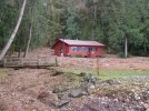
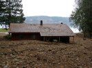
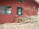
In one 1/4 mile they lost either 3 or 6 bridges on the Tahuya River trail (IIRC). I can't recall if it was 3 or 6, but it was all of them, each of them built out of steel and 100' long. The riverbed is now 300' wide. One of their trails has over 100 down trees on it. I understand they have 200 some odd volunteers that have said they are willing to come out to help, but they have to figure out a plan first. It's a major mess, lets put it this way, when the DNR was surveying the damage the highlights were one relocated house that went down river and is now on a bank and a school bus (no one got hurt).

As such, the 4x4 system is getting closed down again to protect it from overuse and abuse. The plan was to open it, but with the staging areas closed the users out there already started staging at the trail head. Rolling Eyes They did get punted out of there though. Then the issue is with ATV and MC userbuilts popping up in the 4wd system to avoid all the water holes, or just flat out overuse. To understand that, imagine having all the users over 20,000 some odd acres squished in to 1200.

We are talking about what *could* be a 3-4 week closure until some of the ATV/MC trails can be re-opened. As much as that sucks, it could be a LOT worse, afterall, we can't all use the trails quiet yet, but they are largely ok and really have no work to do minus the culvert thing and re-opening broken axle. Certainly not enough to call a work party for 4x4 trail related reasons.

Even with it open, if you are caught off a designated trail or undoing or bypassing a closure, especially now. You'll not only face a guaranteed $134-500 ticket, but you stand a good chance of getting your rig impounded.

Lets get on to the better news.

1) It sounds promising that we may be able to sign off the 4x4 trail head as "4wd only, no ATV or MC" and get it back open very soon. I'm pushing to get it open again ASAP.

2) Broken Axle hill - I think we can keep it as is. I'll talk further with the DNR, but if we can work out some warning signage and a speed reducer, such as some logs across the trail a 4x4 can get over but an ATV or MC can't get over without working at it at the top of the hill. That may very well take care of their liability concerns. The crack you see in the pictures is about 3' deep and 1-2' wide.

3) The culvert - there's still 8" of water over it. So South Loop isn't a loop until the water recedes. I looked at it today and decided unblocking the pipes wasn't going to be happening until the water level came down. Honestly, it needs to be replaced, but being a class 3 stream it would need an EA (environmental assessment) and since we'd have to dig deeper than 2' another agency (forgot the name) gets involved. PAIN IN THE ASS - this is why it is so important to stay off it.

4) All that stands between spillman and it getting open again is some materials to rebuild a section of fence. Just have to find them. I might go for a walk down river next week and see if I can. Laughing

5) horse camp, there's some 80-100' really dangerous leaners that need to be delt with and that massive crater that you saw in the pictures. But even before that can really open, spillman road must be repaired.

I think that covered everything, but ask if there is something I missed.

I am just going to have to ask for everyone's patience in this. Think of it as an opportunity to do some long needed maintenance or repairs on your rig. Smile
 
Thanks for the update Travis:awesomework: can you post this up on the PNW site as well? Thanks Jim
 
Where are these pics at? I guess it's a good thing my truck is almost wheelable if my bike is going to be parked all winter.
 
My Uncle sent me pictures of his cabin out by Tahuya. The whole hill came down and ingulfed it. :eeek:
 

Attachments

  • PC090082.JPG
    PC090082.JPG
    92.2 KB · Views: 107
  • PC090105.JPG
    PC090105.JPG
    77.1 KB · Views: 109
damn thats alot of cleaning up to do.

At least it's still there.

I'll see if I can get a copy of the pics the DNR took. An entire rambler that is at LEAST that size was picked up and deposited on a high bank along the Tahuya River.
 
Doesn't SHIFTY have property out this way?? or is that his? I remember last years storm washing away someones bank. I think it was Shifty. :eeek:
 
At least it's still there.

I'll see if I can get a copy of the pics the DNR took. An entire rambler that is at LEAST that size was picked up and deposited on a high bank along the Tahuya River.
I don't know how it stood, there is no foundation, it is just pier and beam.
 
Yea, but there's 3-4 feet of mud up against the back of it.
 

Attachments

  • PC090101.JPG
    PC090101.JPG
    75.2 KB · Views: 80
Top