Well ther is a couple of ideas floating around in how:eeek: interesting
-
Help Support Hardline Crawlers :
You are using an out of date browser. It may not display this or other websites correctly.
You should upgrade or use an alternative browser.
You should upgrade or use an alternative browser.
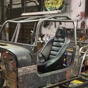
The Reiter build thread
- Thread starter nowires
- Start date
Ty.
Well-Known Member

Yea....I'm bored...:redneck:
I see subliminal sex messages in this..
Say Easy Medium Hard Direction 5 times fast.
boardbysled
Tree Nerd.
Nice I like it
E mail it to me in eather a PDF or what ever
Sent.
Best I could do in 15 min:redneck: If I knew the terrain better, I could match the harder trails to the harder natural terrain.
So, in this version, the harder trails would be made harder by man made obsticles, such as, large boulders (4+ feet diameter), concrete water falls, and any other various hard obsticles. Buggy/truggy level challenging, 40"+,
Easy trails would be rated about tahyua level. Stockish/DD rigs 32-35's
Medium level trails would be a challenege in a built yota/jeep on 37's
Large yellow area is a large playground, maybe pyramid shapped cement structure with natural rocks layed into it?
boardbysled
Tree Nerd.
I see subliminal sex messages in this..
Say Easy Medium Hard Direction 5 times fast.
Shhhhhh!!!!:;

NotSoPC
Well-Known Member
What would be nice is some pics of what the area that we will be getting looks like from the ground. This would help those of us who dont know the area well or at all. I myself have never been soo I have really no idea what could be done in that area:awesomework:
Is there gonna be a connecter between the two areas other than the main road
thinking like this
View attachment 43101
Attachments

Money Mark
Well-Known Member
- Joined
- May 19, 2006
- Messages
- 563
thinking like this
View attachment 43101
And to clarify for folks that don't know the area well........that yellow line would be using an EXISTING road/trail.
tryedWhat would be nice is some pics of what the area that we will be getting looks like from the ground. This would help those of us who dont know the area well or at all. I myself have never been soo I have really no idea what could be done in that area:awesomework:
I just have a problem, getting pics that just don't look like a forest
thanks ther budAnd to clarify for folks that don't know the area well........that yellow line would be using an EXISTING road/trail.
What would be nice is some pics of what the area that we will be getting looks like from the ground. This would help those of us who dont know the area well or at all. I myself have never been soo I have really no idea what could be done in that area:awesomework:
You have never been to reiter ?
You have never been to reiter ?
Nope I never have but I watch youtube and espn, So I think I get it covered:fawkdancesmiley:
Money Mark
Well-Known Member
- Joined
- May 19, 2006
- Messages
- 563
If they are gonna do that why not open the sandhills and the tilt back up it would take you right up to the new spot
Petty sure the DNR does not want us driving ALONG the powerlines anymore. Crossing is ok (maybe) but no more free-for-all powerline trails.
If they are gonna do that why not open the sandhills and the tilt back up it would take you right up to the new spot
Index water shed problems with that.
Nope I never have but I watch youtube and espn, So I think I get it covered:fawkdancesmiley:
Jackass :fawkdancesmiley:
Petty sure the DNR does not want us driving ALONG the powerlines anymore. Crossing is ok (maybe) but no more free-for-all powerline trails.
Well that would explain it.
So could we use the existing road that leaves the old campground and cross the sand hills up top somewhere. Or is that the road you where showing on your map
Money Mark
Well-Known Member
- Joined
- May 19, 2006
- Messages
- 563
Well that would explain it.
So could we use the existing road that leaves the old campground and cross the sand hills up top somewhere. Or is that the road you where showing on your map
Doubt it. Even nowires "yellow line trail" is out of the concept area's 1 and 2, on the map.
We're hoping for some leniency on this access-only trail.
the road that I am showing is where the tank traps are on dear creek flats road and then cuts up to the other road. So I guess y"yes " to your questianWell that would explain it.
So could we use the existing road that leaves the old campground and cross the sand hills up top somewhere. Or is that the road you where showing on your map
Na the yellow line is good. We can have hardened roads threw the aquafer recharge area that were pre existingDoubt it. Even nowires "yellow line trail" is out of the concept area's 1 and 2, on the map.
We're hoping for some leniency on this access-only trail.