-
Help Support Hardline Crawlers :
You are using an out of date browser. It may not display this or other websites correctly.
You should upgrade or use an alternative browser.
You should upgrade or use an alternative browser.
Stony Lonesome Night Ride this weekend
- Thread starter patooyee
- Start date
L
lowbudgetjunk
Guest
A lot of folks still have the RZR stigma attached to the park. Once your brain settles back into its upright position, give me an honest opinion of the place and what else you would like to see.
jwilson645
Well-Known Member
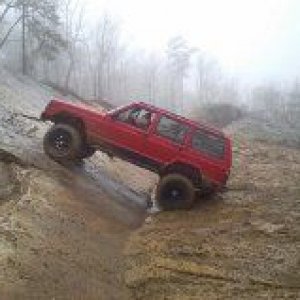
What the hell is going on right there? Ain't nothing about it looks good.
Eddyj
Well-Known Member
The lights are so bright, it's must be blinding him. 

ExpensiveDreams
Well-Known Member
Must be what we call "switch back" trail on past Hello Kitty. It does have very tight turns.
Stony_Lonesome_OHV_Park
Well-Known Member
- Joined
- Sep 26, 2013
- Messages
- 160
You got it Bobby. Looks like a fun ride to me! 

YouBreakYouBuy
Member
- Joined
- Dec 31, 2013
- Messages
- 10
Re:
Heck I have back up sometimes to make it up switchback in the rzr.
Sent from my VS980 4G using Tapatalk
Heck I have back up sometimes to make it up switchback in the rzr.
Sent from my VS980 4G using Tapatalk
L
lowbudgetjunk
Guest
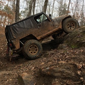
Switchback at nighttime , when wet, in a full size, not a good idea
jwilson645
Well-Known Member
lowbudgetjunk said:Switchback at nighttime , when wet, in a full size, not a good idea
.................on shitty military Goodyears, with no winch
L
lowbudgetjunk
Guest
Any other pictures from the weekend? That can't be JJ's only pictures and videos.
patooyee
Well-Known Member
- Joined
- Sep 27, 2008
- Messages
- 5,692
I'm not aware of any other pics or vids. Maybe The Boss got some, but I don't think so.
I don't have many suggestions for the park to be honest. Its already one of the nicest ones I've been to, it has plenty of stuff for the 4x4's to do. We spent all day Fri. for the most part riding and only saw like half of the park. I'm no good at reading maps butThe Boss is and even he had a hard time keeping track of where we were. But the thing is that the maps ya'll have are some of the best ones of any of the parks I've been to. They're just so detailed with so many trails its a little confusing. You definitely need to have a numbered legend or something so that we can use trail names to judge where we are. That would probably be the biggest thing. There were tons of times where we were sitting in front of a named trail but had no way to tell which red line it was on the map. That's really my only gripe. I'll definitely be back to stay in a cabin again. Maybe not when its so cold though!
I don't have many suggestions for the park to be honest. Its already one of the nicest ones I've been to, it has plenty of stuff for the 4x4's to do. We spent all day Fri. for the most part riding and only saw like half of the park. I'm no good at reading maps butThe Boss is and even he had a hard time keeping track of where we were. But the thing is that the maps ya'll have are some of the best ones of any of the parks I've been to. They're just so detailed with so many trails its a little confusing. You definitely need to have a numbered legend or something so that we can use trail names to judge where we are. That would probably be the biggest thing. There were tons of times where we were sitting in front of a named trail but had no way to tell which red line it was on the map. That's really my only gripe. I'll definitely be back to stay in a cabin again. Maybe not when its so cold though!
muddinmetal
Guntersville, AL
I also had a similar issue with the map. I would get so turned around that even when I saw one of the well marked entrances to a trail, I still didn't know which way I was facing in relation to the map
John Galbreath Jr.
38 Special & Solo Buggy
- Joined
- May 24, 2007
- Messages
- 8,613
We need an iPhone "You Are Here" trail map app.
85toyo
Well-Known Member
patooyee
Well-Known Member
- Joined
- Sep 27, 2008
- Messages
- 5,692
I've always wondered this but couldn't a park owner / operator simply create their own share-able and free Google Map by simply going to the beginning of each trail and adding a thumb tack with the trail name? Then a trail user could simply open the free map and see all the points on the trail easily. Of course, the actual trails wouldn't be on the Google map but the owner / operator could simply superimpose their hand drawn trails on the printed Google map. I think between GPS and a good printed map it would be very difficult to not know where you were.
RustyC
Well-Known Member
- Joined
- Dec 15, 2010
- Messages
- 1,251
Old Adam Sandler comedy. Hide the kids. (Language)
(Adam Sandler - The Goat (Skit))
(Adam Sandler - The Goat (Skit))
grcthird
Birmingham, AL
Careful Rusty, they're all gonna laugh at you! laughing1
race_jeep
Well-Known Member
I used to love that cd! I dunno they ****in superimposed me!RustyC said:I have only heard the word superimpose one other time. By a talking goat tied to a truck with a three foot rope.

