• Help Support Hardline Crawlers :

How wide are you

great example Mark

After scanning the original map, the pink line turned into a faded green-ish.:eeek:You get the idea though.....the 2 trails would only share portions of the same "trail".


So in that case there would be a bunch of single track only trail built. Is that the plan for the upcomming Reiter system? To build single track only trails? Judging by earlier comments in this thread it doesn't sound like it....
 
Maps can be confusing. You may also slightly expand the map view by clicking on the upper margin on the photo.

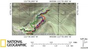
There are two lines (trails) within the "boundary".....represented by red. One line is one 2x2 trail (blue), one line is one 4x4 trail (pink, green, whatever).

This is just an EXAMPLE as to what a reasonable compromise could look like on a map......if we can't get our own seperate trail areas. (4x4 vs. 2x2)
 
Last edited:
Your computer sucks :D


Another food for thought for whoever the "trail designer" is... Something that I have seen down in Oregon (Browns camps?).. the 4x4 (or single track) trails criss-cross with a basically graded logging road. Think of the logging road switching back and forth and the "hard" trails in between the switch backs. Makes is VERY easy to extract broken rigs, keep a group of various ability wheelers together (those not up to the task take the road to the top of the obstacle and wait/watch the rest of the group), also easy for one group to go around another, slower (or broken) group without blazing new trails. I've noticed parts of Naches the same way, the trails are broken up on occasion by the main road, allowing people to move around quite easily and maximize their recreation time.


.


Works great down at TSF, you can take the main road all the way up to the Crushers or run fire break 5 as it winds thorough. Have buddies with less built rigs they just jump on the main road and cruise up past the hard sections and wait for you to hit the main line and off you go again :awesomework:. Break down and its a short pull out to the main road, run down and gets youre tow rig and and youre golden.

They have 4x4,quad, bikes (both motorized and pedal), hiking and horse back trails winding all the way up the main road to the top. Every one has there own seperate trail to play on and keep them happy.:cheer:
 
Your computer sucks :D


Another food for thought for whoever the "trail designer" is... Something that I have seen down in Oregon (Browns camps?).. the 4x4 (or single track) trails criss-cross with a basically graded logging road. Think of the logging road switching back and forth and the "hard" trails in between the switch backs. Makes is VERY easy to extract broken rigs, keep a group of various ability wheelers together (those not up to the task take the road to the top of the obstacle and wait/watch the rest of the group), also easy for one group to go around another, slower (or broken) group without blazing new trails. I've noticed parts of Naches the same way, the trails are broken up on occasion by the main road, allowing people to move around quite easily and maximize their recreation time.


food for thought. Doesn't work in all situations, but if the terrain allows it, can have its advantages.

Works great down at TSF, you can take the main road all the way up to the Crushers or run fire break 5 as it winds thorough. Have buddies with less built rigs they just jump on the main road and cruise up past the hard sections and wait for you to hit the main line and off you go again :awesomework:. Break down and its a short pull out to the main road, run down and gets youre tow rig and and youre golden.

They have 4x4,quad, bikes (both motorized and pedal), hiking and horse back trails winding all the way up the main road to the top. Every one has there own seperate trail to play on and keep them happy.:cheer:

Some of the walker trails are like this too...It's a great idea I hope dnr see's it that way too..:awesomework:
 
Maps can be confusing. You may also slightly expand the map view by clicking on the upper margin on the photo.

There are two lines (trails) within the "boundary".....represented by red. One line is one 2x2 trail (blue), one line is one 4x4 trail (pink, green, whatever).

This is just an EXAMPLE as to what a reasonable compromise could look like on a map......if we can't get our own seperate trail areas. (4x4 vs. 2x2)

That's a nice job of side stepping the question but it has still not been answered....Are there single track only trails in the plan for the new Reiter?

So in that case there would be a bunch of single track only trail built. Is that the plan for the upcomming Reiter system? To build single track only trails? Judging by earlier comments in this thread it doesn't sound like it....
 
Here is another example of what the idea is
Red is 4 WD
Blue is quads
Green is Bikes

View attachment 36520
 

Attachments

  • Multi1.jpg
    Multi1.jpg
    47 KB · Views: 112
Last edited:
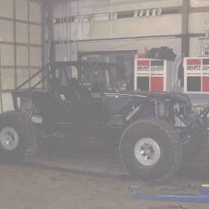
Running 81" but I could knock it down 3". Its a 1988 4runner with d60 and 14bolt. WB is 108-112" when I am done.
 
DNR Email received 10/20/2009

----- Original Message -----
From: DNR RE Reiterfoothills
To: DNR RE Reiterfoothills
Sent: Tuesday, October 20, 2009 9:59 AM
Subject: Upcoming restoration and trail work at Reiter Foothills - October 22 Meeting


Greetings -


The Washington State Department of Natural Resources (DNR) recently sent an invitation to an October 20 meeting to discuss several important developments regarding Reiter Foothills. This e-mail is to let you know the meeting has been re-scheduled. There is a lot of interest in the information we plan to share, and we needed a larger meeting space.

The Washington State Department of Natural Resources (DNR) is hosting an informal meeting for interested recreationists who want to learn more about winter restoration and trail planning in Reiter Foothills Forest. The meeting is from 6 p.m. to 8 p.m., October 22 at the Park Place Middle School Commons, 1408 West Main, in Monroe.


At the October 22 meeting, you can learn more about what actions DNR will be taking in the coming months to restore the environmental health of the area and determine where trails, both motorized and non-motorized, will be located for long-term, sustainable use. The meeting will also provide you with an opportunity learn how you can volunteer to help restore the area and get involved in creating recreation opportunities.


Please forward this information to any people you shared the original invitation with.


Candace Johnson

Washington State Department of Natural Resources
 
Anyone have a full list of the Reiter Foothills planning committee members? I cannot find it anywhere. There will be about 28 names on it.
 
Anyone have a full list of the Reiter Foothills planning committee members? I cannot find it anywhere. There will be about 28 names on it.

I found this, so how do you come up with 28?

DNR Reiter Foothills Recreation Planning Committee Info
On 3/28/08, Jon Kennedy was appointed to the DNR Reiter Foothills Recreation Planning Committee. This is a 12 person panel whose role is to provide insight and input to help the DNR make decisions related to recreation management for the Reiter Foothills Forest. The group will work with the DNR staff to develop draft recreation management recommendations. These recommendations must:

1. Be consistent with the purpose and objectives of State Forest Trust Lands;
2. Not adversely impact revenue generation from timber sales and special forest products for DNR trust beneficiaries and counties;
3. Not adversely impact ecological functions
4. Not favor any user group over another; and
5. Recognize Reiter Foothills Forest is a working forest and is part of a larger regional landscape.
 
Anyone have a full list of the Reiter Foothills planning committee members? I cannot find it anywhere. There will be about 28 names on it.

There was a list released on the DNR website but trying to locate it--is not an easy task but its there corey.
 
I was wrong on the number but still no list? I looked all over the DNR website and all the Reiter threads too.
 
Anyone have a full list of the Reiter Foothills planning committee members? I cannot find it anywhere. There will be about 28 names on it.

But then I found this. Still no names.

The planning process
Since April 2008, a 15-member advisory committee of motorized and non-motorized recreation users, local citizens, surrounding property managers, and city and county representatives have been working collaboratively to create a long-term plan for recreation in Reiter Foothills. The group meets regularly to learn more about the recreational needs in the area and to determine how best to provide for different types of recreational uses.

What is the timeline for recreation planning in Reiter?
January 2008
 
Here is another example of what the idea is
Red is 4 WD
Blue is quads
Green is Bikes

View attachment 36520
One quick comment about a map like that, from my perspective, is that bikes travel at much faster speeds through the forests than y'all do. A fairly flat 5 mile trail is maybe 30 minutes of fun for someone on a motorcycle. A typical leasurly ride for us at Reiter is about 20-30 miles of single track in 4-5 hours. At race pace we were averaging double that or more. On the other side of the mountians, 100 mile day trips are not out of the ordinary.

My perception is that a 5-7 mile trail can be a half-day affair for you guys.

I think the best solution is figuring out where each user group can build and maintain trails while meating the above criteria for land use. Mile-for-mile isn't a good way to determin if one group is getting favored. If there are more spots that bikes can build and maintain trails without impacting revenue, ecology, etc, so be it.
 
I agree.

Mile-to-mile, 2x2's need 4 times the amount of trail a 4x4 does.

We're still dreaming up idea's here though. So be open-minded......every last one.:;
 
Anyone have a full list of the Reiter Foothills planning committee members? I cannot find it anywhere. There will be about 15 names on it.

I found out that the list is not public info. Next month the public can send in comments about the committees plan and the DNR will review the comments and maybe make changes.
 
Top